Year of Issue
2024
General
National Id
CH_04
Site name
Petite Glâne River Basin
Summary
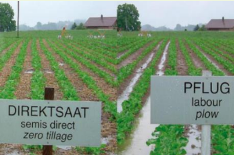
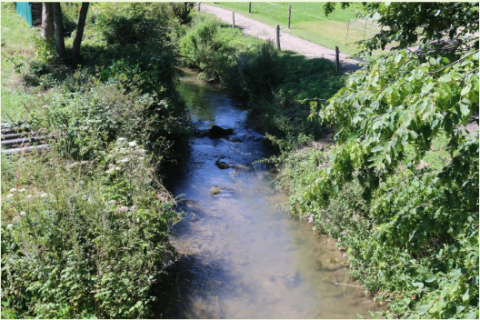
The case study area “Petite Glâne” belongs to the Broye catchment in the southwestern part of the Swiss Plateau. The river Petite Glâne is about 30 km long, repeatedly crosses borders between the cantons of Vaud and Fribourg, and has a catchment area of 94 km2. Its upper reaches have remained fairly natural and are lined with forest, whereas its lower reaches in the Broye plain have been canalized and straightened. The soils and climate here are highly suitable for arable farming. Overall, the catchment of the Petite Glâne is strongly characterized by agriculture: nearly three quarters of its area consists of pastures and cropland. However, the region is increasingly experiencing water shortages in summer, and there is often not enough water in the Broye and Petite Glâne to irrigate the fields. Climate change will further aggravate the situation. Farmers are therefore considering new options to mitigate the increasing drought events – for example an irrigation project using water from Lake Neuchâtel.
Against this background, OPTAIN explores efficient land use and land management strategies as well as technical measures that increase the capacity of soils to absorb and store water while improving nutrient retention and decomposition. These natural and small water retention measures (NSWRMs) are discussed and evaluated jointly with regional stakeholders. Based on model calculations, OPTAIN works to determine the maximum possible water and nutrient retention potential that can be achieved with NSWRMs if they are optimally combined and positioned in the catchment. Although the focus is on the Petite Glâne, the case study extends to the entire Broye catchment when it comes to modelling and stakeholder involvement.
The OPTAIN project will support the case study team with identifying and developing efficient land management strategies and small technical solutions to improve the soils’ infiltration and water holding capacities as well as its capacity to filter, buffer and transform pollutants.
Project
Optain
Light or indepth?
Light
The in-depth description of the case study
Transboundary
0
NWRM(s) implemented in the case study
Optain's measures
Longitude
6.89970
Latitude
46.83664
Site information
Climate zone
cool temperate moist
Mean annual rainfall
900 - 1200 mm
Depth groundwater
5 - 50 m
Average slope range
moderate (6 - 10%)
Monitoring maintenance
Monitoring impacts effects
0
Design & implementations
Age
10 - 50 years
Public consultation
0
Contractural arrangements
0
Design contractual arrangement
| Arrangement type | Responsibility | Role | Comments | Name |
|---|---|---|---|---|
Design consultation activity
| Activity stage | Key issues | Name | Comments |
|---|---|---|---|
Design land use change
| Land use change type |
|---|
Design authority
| Authority type | Role | Responsibility | Name | Comments |
|---|---|---|---|---|
Lessons, risks, implications...
Financing mechanism
0
Success factor(s)
| Success factor type | Success factor role | Comments |
|---|---|---|
Financing
| Financing type | Comments |
|---|---|
Driver
| Driver type | Driver role | Comments |
|---|---|---|
Financing share
| Financing share type | Share | Comments | |
|---|---|---|---|
Policy, general governance and design targets
Policy description
Project developed in coordination with the following stakeholders: Authorities of the agricultural sector, authorities of the environment sector, famer associations, local farmers, NGOS, and AGRIDEA
Part of wider plan
0
Policy target
| Target purpose |
|---|
Policy pressure
| Pressure directive | Relevant pressure |
|---|---|
Policy area
| Policy area type | Policy area focus | Name | Comments |
|---|---|---|---|
Policy impact
| Impact directive | Relevant impact |
|---|---|
Policy wider plan
| Wider plan type | Wider plan focus | Name | Comments |
|---|---|---|---|
Policy requirement directive
| Requirement directive | Specification |
|---|---|
Photo gallery