Year of Issue
2024
General
National Id
DE_07
Site name
Schawrzer Schöps
Summary
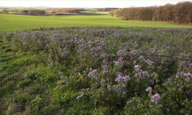
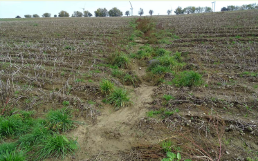
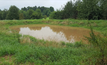
The Schwarzer Schöps case study is located in the East of Germany. The catchment area is about 136 km2, most of which is used as cropland (54%) and grassland (20%). The area is facing an increase in severe floods, soil erosion, and droughts, with negative implications for crop yield stability. In addition, the downstream reservoir Quitzdorf suffers more often from low water tables and high phosphorus pollution which is causing blue-green algae bloom and threatening its multiple services, in particular its important role for nature protection, recreation, and maintaining downstream environmental flows.
The OPTAIN project will support the case study team with identifying and developing efficient land management strategies and small technical solutions to improve the soils’ infiltration and water holding capacities as well as its capacity to filter, buffer and transform pollutants.
The OPTAIN project will support the case study team with identifying and developing efficient land management strategies and small technical solutions to improve the soils’ infiltration and water holding capacities as well as its capacity to filter, buffer and transform pollutants.
Project
Optain
Light or indepth?
Light
The in-depth description of the case study
NUTS Code
Stockholm
Transboundary
0
Data provider
Helmholtz-Centre for Environmental Research (UFZ)
NWRM(s) implemented in the case study
Optain's measures
Longitude
14.792066
Latitude
51.226066
Monitoring maintenance
Monitoring impacts effects
0
Design & implementations
Public consultation
0
Contractural arrangements
0
Design contractual arrangement
| Arrangement type | Responsibility | Role | Comments | Name |
|---|---|---|---|---|
Design consultation activity
| Activity stage | Key issues | Name | Comments |
|---|---|---|---|
Design land use change
| Land use change type |
|---|
Design authority
| Authority type | Role | Responsibility | Name | Comments |
|---|---|---|---|---|
Lessons, risks, implications...
Financing mechanism
0
Success factor(s)
| Success factor type | Success factor role | Comments |
|---|---|---|
Financing
| Financing type | Comments |
|---|---|
Driver
| Driver type | Driver role | Comments |
|---|---|---|
Financing share
| Financing share type | Share | Comments | |
|---|---|---|---|
Policy, general governance and design targets
Policy description
The river basin has faced increasing numbers of climatic events such as floods and droughts as well as increased soil erosion. This has impacted the quantity and quality of the Quitzdorf reservoir, located at basin outlet. The reservoir is a key water resource for the region and notably Berlin. It is used as a service water supply, for downstream flood protection, to increase downstream flow, as well as for recreation and nature protection. Pollution of the reservoir has resulted in strong eutrophication, blue-green algae blooms, and the poor ecological status of the water body.
The project will be implemented with a variety of stakeholders including: Saxon State Office for Environment, Agriculture and Geology, the State Reservoir Administration of Saxony, the Saxon Farmers’ Association, as well as local farmers and stakeholders implicated in landscape management and conservation.
The project will be implemented with a variety of stakeholders including: Saxon State Office for Environment, Agriculture and Geology, the State Reservoir Administration of Saxony, the Saxon Farmers’ Association, as well as local farmers and stakeholders implicated in landscape management and conservation.
Part of wider plan
0
Policy target
| Target purpose |
|---|
|
Runoff control
|
|
Peak-flow reduction
|
|
Pollutants Removal
|
|
Erosion Control
|
Policy pressure
| Pressure directive | Relevant pressure |
|---|---|
|
WFD identified pressure
|
Policy area
| Policy area type | Policy area focus | Name | Comments |
|---|---|---|---|
Policy impact
| Impact directive | Relevant impact |
|---|---|
Policy wider plan
| Wider plan type | Wider plan focus | Name | Comments |
|---|---|---|---|
Policy requirement directive
| Requirement directive | Specification |
|---|---|
Photo gallery


