Typically, overland flow areas are set asides used to minimize the negative impacts of forest management on water quality. They are most commonly associated with peatland forestry in Finland but could be applicable in other areas of Europe. Overland flow areas collect some of the excess sediment produced during ditch maintenance and other forest management operations such as road building or harvesting. Overland flow areas are created by building a semi-permeable dam in a forest ditch. Upstream of the dam, lateral ditches are constructed to transport water into the surrounding catchment. During periods of high flow, water will overflow the lateral ditches and travel across land to reach the receiving lake or stream. As the water travels across land, its velocity will be slowed and much of the sediment being carried will be deposited. At periods of low flows, the permeable dam will slow water flow and cause deposition of sediment. Existing wetlands may function as overland flow areas but the use of ecologically valuable and endangered mires should be avoided due to possible changes in vegetation composition. Overland flow areas can also be part of more complex system for water treatment from agricultural areas and landfills.
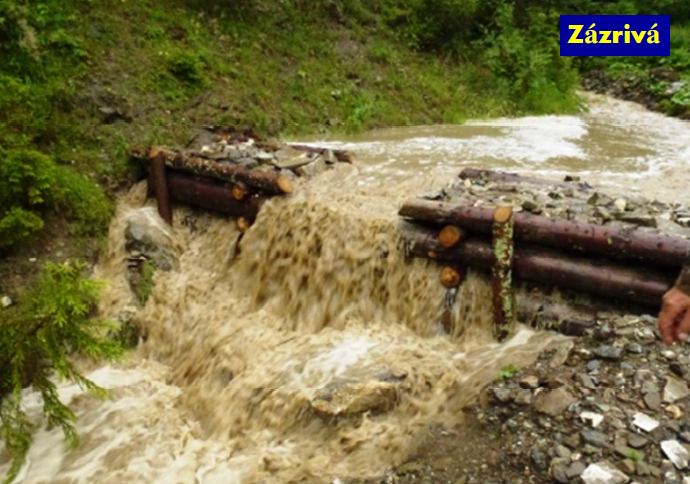
Ditch for overland flow (Slovakia)
Source: Michal Kravcík’s presentation, NWRM Workshop
| Benefits | Level |
|---|---|
|
BP1 - Store runoff
|
High
|
|
BP2 - Slow runoff
|
High
|
|
BP3 - Store river water
|
Low
|
|
BP4 - Slow river water
|
Medium
|
|
BP6 - Increase infiltration and/or groundwater recharge
|
Low
|
|
BP8 - Reduce pollutant sources
|
High
|
|
BP9 - Intercept pollution pathways
|
High
|
|
BP10 - Reduce erosion and/or sediment delivery
|
High
|
|
BP12 - Create aquatic habitat
|
Low
|
|
ES1 - Water storage
|
Medium
|
|
ES2 - Fish stocks and recruiting
|
Medium
|
|
ES4 - Biodiversity preservation
|
Medium
|
|
ES6 - Groundwater/aquifer recharge
|
Low
|
|
ES7 - Flood risk reduction
|
High
|
|
ES8 - Erosion/sediment control
|
High
|
|
ES9 - Filtration of pollutants
|
High
|
|
BP7 - Increase soil water retention
|
Medium
|
|
PO1 - Improving status of biology quality elements
|
Low
|
|
PO2 - Improving status of physico-chemical quality elements
|
Low
|
|
PO3 - Improving status of hydromorphology quality elements
|
Low
|
|
PO4 - Improving chemical status and priority substances
|
Low
|
|
PO5 - Improving quantitative status
|
Low
|
|
PO7 - Prevent surface water status deterioration
|
Medium
|
|
PO9 - Take adequate and co-ordinated measures to reduce flood risks
|
High
|
|
PO10 - Protection of important habitats
|
Medium
|
|
PO11 - Better protection for ecosystems and more use of Green Infrastructure
|
Medium
|
|
PO12 - More sustainable agriculture and forestry
|
Medium
|
|
PO13 - Better management of fish stocks
|
Medium
|
|
PO14 - Prevention of biodiversity loss
|
Medium
|