Year of Issue
2024
General
National Id
NO
Site name
Hobølelva River
Summary
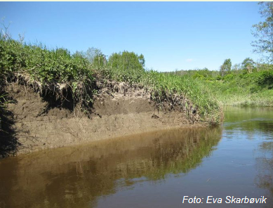
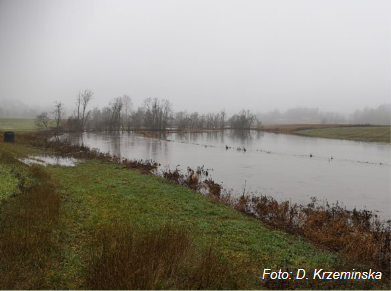
The Kråkstadelva catchment, as case study area, is located within the Hobølelva watershed, located ca. 30km S-SE of Oslo, Norway. The area of the Kråkstadelva catchment is approximately 51 km2. Agricultural land covers ca. 43% of the catchment (22km2) and it is dominated by cereal production. Forest covers ca. 45% of the catchment. Heavy clay soils dominate in the area (up to 80% of clay content). Mean annual temperature is 5.3°C and average annual precipitation is c.a. 864 mm. Floods of varied magnitude occur frequently in the catchment, typically during spring snow melt and autumn rainstorms. The main challenge in the area is water quality (incl. high phosphorus pollution) and soil erosion (incl. riverbank erosion and quick-clay landslides). There is already high focus on environmental mitigation measures, for example reduced tillage (no tillage in autumn), buffer zones, grass-covered water ways, constructed wetlands and the use of catch-crops.
OPTAIN project will support the case study team in identifying new land management strategies, including the best combination and allocation of measures in the catchment as well as implementing new (combinations of) measures, in order to improve water retention in the soil and the landscape and as a result reduce the risk of flooding, and improve water quality downstream.
OPTAIN project will support the case study team in identifying new land management strategies, including the best combination and allocation of measures in the catchment as well as implementing new (combinations of) measures, in order to improve water retention in the soil and the landscape and as a result reduce the risk of flooding, and improve water quality downstream.
Light or indepth?
In-depth
The in-depth description of the case study
RBD code
NO011
Transboundary
0
Data provider
Nibio
NWRM(s) implemented in the case study
Site information
Climate zone
cool temperate moist
Mean annual rainfall
600 - 900 mm
Mean rainfall
Annual precip. (1993-2004): 651-1305 mm.yr-1(avg. 864 mm.yr -1)
Mean rainfall unit
mm/hour
Average temperature
Mean temp.: 5.3°C (annual), -4.8°C (Jan/Feb), 16.1°C (July).
Mean runoff
4.7 m3.s
Remarks runoff imperviousness
Avg. water discharge: ca. 4.7 m3.s (max: 102 m 3.s).
Type
Case Study Info
Average slope range
Elevation range: 25 - 346 m a.s.l.
Vegetation class
In the North: mainly forested with Pre-Cambrian bedrock. The land use is 79% forest, 16% agriculture and 5% water areas.
Monitoring maintenance
Monitoring impacts effects
0
Design & implementations
Public consultation
0
Contractural arrangements
0
Design contractual arrangement
| Arrangement type | Responsibility | Role | Comments | Name |
|---|---|---|---|---|
Design consultation activity
| Activity stage | Key issues | Name | Comments |
|---|---|---|---|
Design land use change
| Land use change type |
|---|
Design authority
| Authority type | Role | Responsibility | Name | Comments |
|---|---|---|---|---|
Lessons, risks, implications...
Financing mechanism
0
Success factor(s)
| Success factor type | Success factor role | Comments |
|---|---|---|
Financing
| Financing type | Comments |
|---|---|
Driver
| Driver type | Driver role | Comments |
|---|---|---|
Financing share
| Financing share type | Share | Comments | |
|---|---|---|---|
Policy, general governance and design targets
Policy description
Local involvement has been extensive since around 1990 as catchment has been used as a study site in many projects, e.g., EU FP7 Refresh, EuroHarp, H2020 Recare). NIBIO has arranged many workshops with stakeholders of this catchment:
- Farmers and land owners;
- Water boards: local (for the catchment) and regional (for the river basin of Glomma);
- Municipalities;
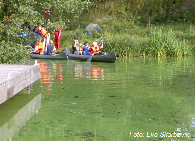
- Boaters, canoes (mainly in the lake), local communities;
- Drinking water supply company (MOVAR);
- Environmentalists (f.ex., SABIMA);
- Hunting and fishing associations;
- Tourist association (Turistforeningen);etc.
Part of wider plan
0
Policy target
| Target purpose |
|---|
|
Erosion Control
|
|
Peak-flow reduction
|
|
Pollutants Removal
|
Policy pressure
| Pressure directive | Relevant pressure |
|---|---|
Policy area
| Policy area type | Policy area focus | Name | Comments |
|---|---|---|---|
Policy impact
| Impact directive | Relevant impact |
|---|---|
Policy wider plan
| Wider plan type | Wider plan focus | Name | Comments |
|---|---|---|---|
Policy requirement directive
| Requirement directive | Specification |
|---|---|
Photo gallery


