Filter strips are uniformly graded, gently sloping, vegetated strips of land that provide opportunities for slow conveyance and (commonly) infiltration. They are designed to accept runoff as overland sheet flow from upstream development and often lie between a hard-surfaced area and a receiving stream, surface water collection, treatment or disposal system.
Filter strips are generally planted with grass or other dense vegetation to treat the runoff through vegetative filtering, sedimentation, and (where appropriate) infiltration. They are often used as a pre-treatment technique before other sustainable drainage techniques (e.g. swales, infiltration and filter trenches). Filter strips are best suited to treating runoff from relatively small drainage areas such as roads and highways, roof downspouts, small car parks, and pervious surfaces.
Filter strips can serve as a buffer between incompatible land uses, and can provide locations for groundwater recharge in areas with pervious soils. Filter strips are often integrated into the surrounding land use, for example public open space or road verges. Local wild grass and flower species can be introduced for visual interest and to provide a wildlife habitat.
 |
 |
|
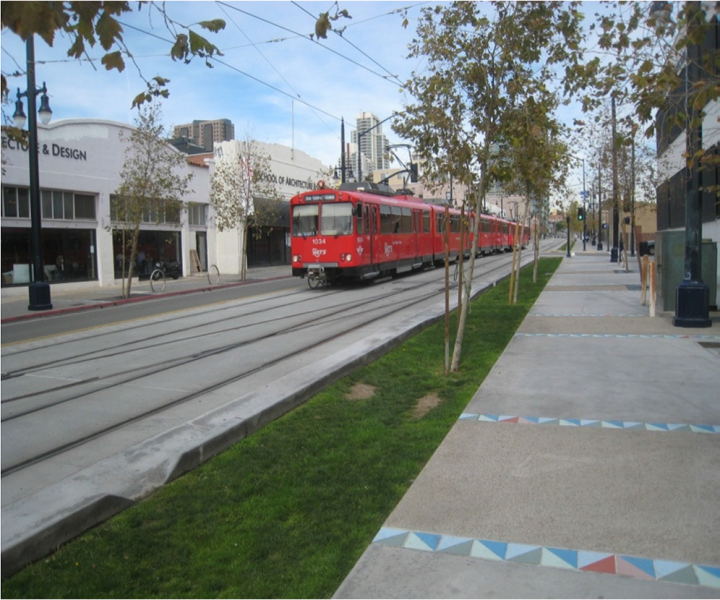
Small filter strip in urban area Source: Andras Kis’ presentation, NWRM Workshop 1 |
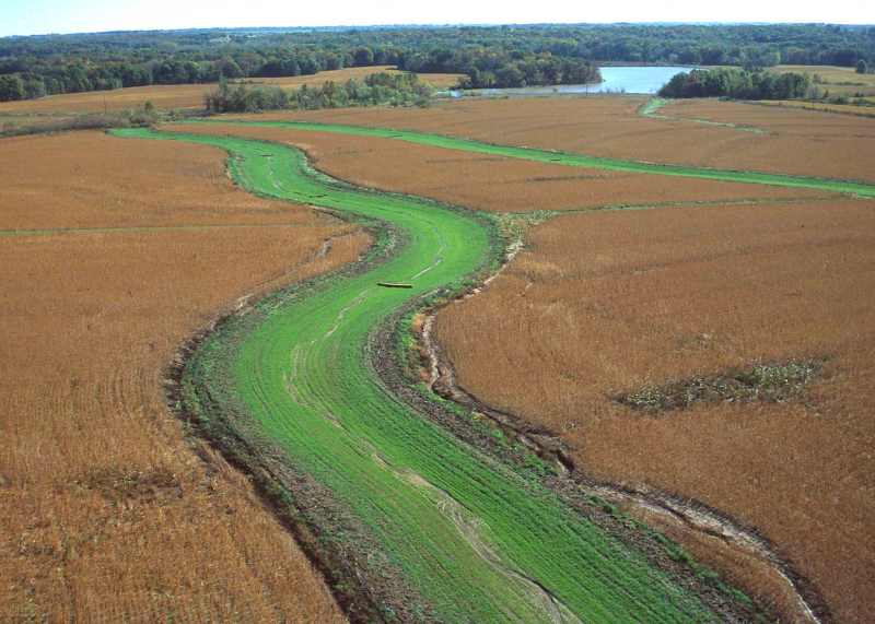
Filter strip in agriculture area Source: http://www.nrcs.usda.gov/Internet/FSE_MEDIA/nrcs144p2_021118.jpg |
| Benefits | Level |
|---|---|
|
ES3 - Natural biomass production
|
Low
|
|
ES4 - Biodiversity preservation
|
Medium
|
|
ES5 - Climate change adaptation and mitigation
|
Low
|
|
ES6 - Groundwater/aquifer recharge
|
Low
|
|
ES7 - Flood risk reduction
|
Low
|
|
ES8 - Erosion/sediment control
|
Medium
|
|
ES9 - Filtration of pollutants
|
High
|
|
ES11 - Aesthetic/cultural value
|
Medium
|
|
PO2 - Improving status of physico-chemical quality elements
|
Low
|
|
PO4 - Improving chemical status and priority substances
|
Low
|
|
PO7 - Prevent surface water status deterioration
|
Medium
|
|
PO9 - Take adequate and co-ordinated measures to reduce flood risks
|
Low
|
|
PO11 - Better protection for ecosystems and more use of Green Infrastructure
|
Medium
|
|
PO12 - More sustainable agriculture and forestry
|
Low
|
|
PO14 - Prevention of biodiversity loss
|
Medium
|
|
BP2 - Slow runoff
|
Low
|
|
BP6 - Increase infiltration and/or groundwater recharge
|
Low
|
|
BP7 - Increase soil water retention
|
Low
|
|
BP9 - Intercept pollution pathways
|
High
|
|
BP10 - Reduce erosion and/or sediment delivery
|
High
|
|
BP14 - Create terrestrial habitats
|
Medium
|
|
BP16 - Reduce peak temperature
|
Low
|
|
BP17 - Absorb and/or retain CO2
|
Low
|
