Agriculture

Filter Strips

Code
U06
Sector
Urban
Other sector(s)
Agriculture
The complete description of the NWRM
Summary

Filter strips are uniformly graded, gently sloping, vegetated strips of land that provide opportunities for slow conveyance and (commonly) infiltration. They are designed to accept runoff as overland sheet flow from upstream development and often lie between a hard-surfaced area and a receiving stream, surface water collection, treatment or disposal system.

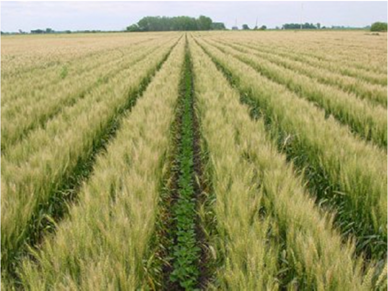
Filter strips are generally planted with grass or other dense vegetation to treat the runoff through vegetative filtering, sedimentation, and (where appropriate) infiltration. They are often used as a pre-treatment technique before other sustainable drainage techniques (e.g. swales, infiltration and filter trenches). Filter strips are best suited to treating runoff from relatively small drainage areas such as roads and highways, roof downspouts, small car parks, and pervious surfaces.

Filter strips can serve as a buffer between incompatible land uses, and can provide locations for groundwater recharge in areas with pervious soils.  Filter strips are often integrated into the surrounding land use, for example public open space or road verges. Local wild grass and flower species can be introduced for visual interest and to provide a wildlife habitat.

Illustration(s)

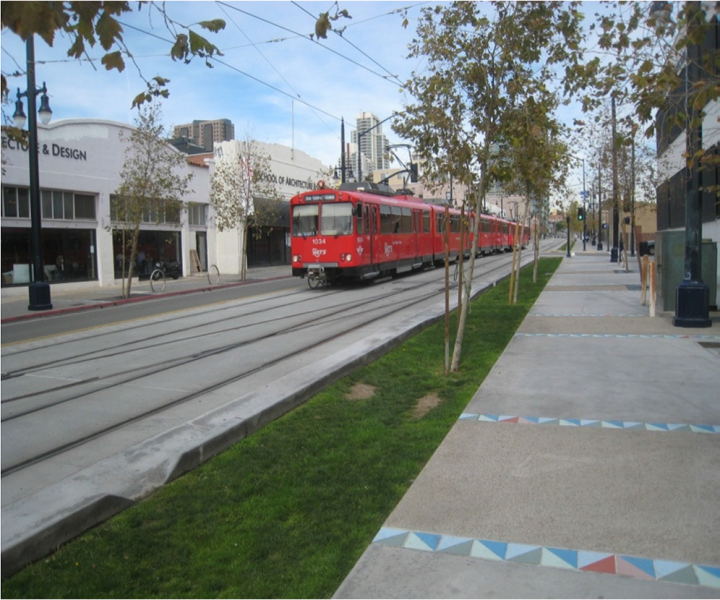
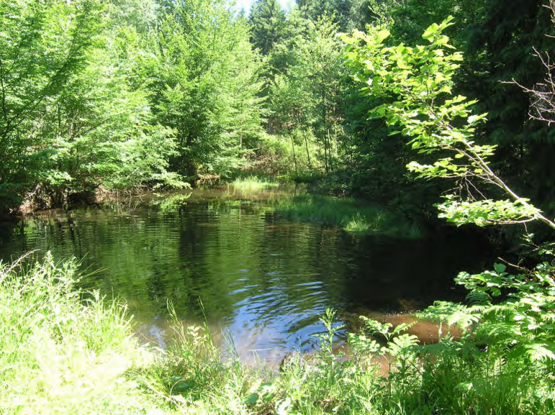
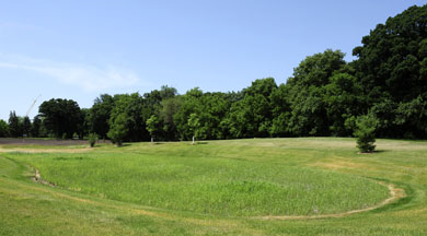
Small filter strip in urban area

Source: Andras Kis’ presentation, NWRM Workshop 1

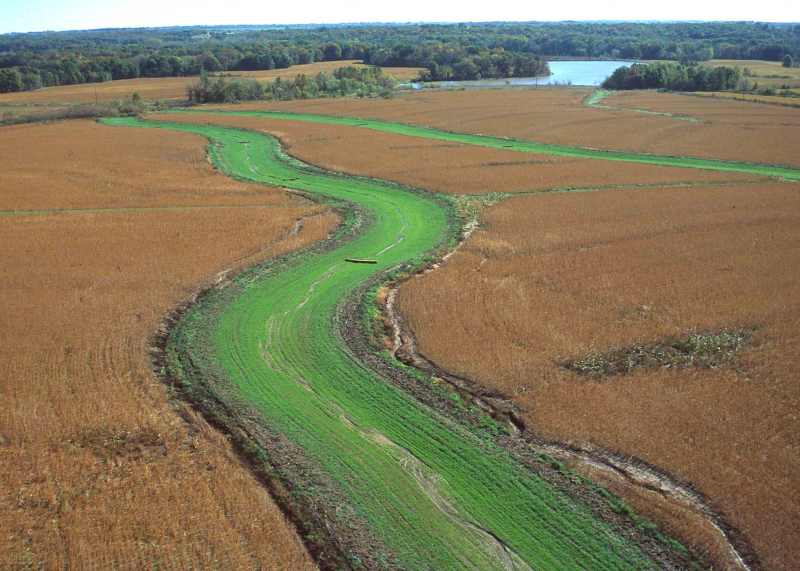
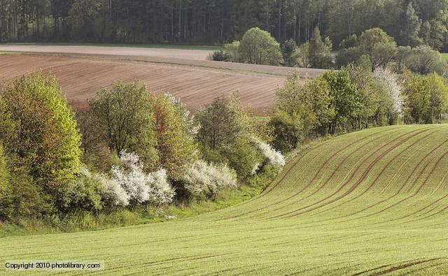
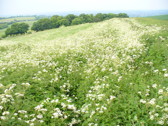
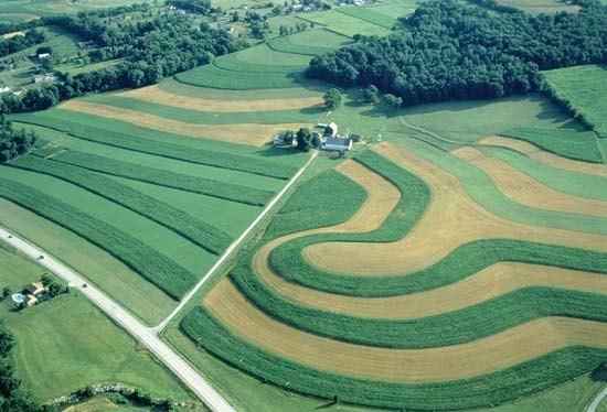
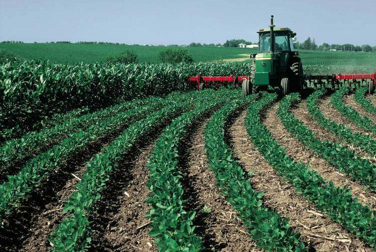
Filter strip in agriculture area

Source: http://www.nrcs.usda.gov/Internet/FSE_MEDIA/nrcs144p2_021118.jpg

Possible benefits with level
Benefits Level
ES3 - Natural biomass production
Low
ES4 - Biodiversity preservation
Medium
ES5 - Climate change adaptation and mitigation
Low
ES6 - Groundwater/aquifer recharge
Low
ES7 - Flood risk reduction
Low
ES8 - Erosion/sediment control
Medium
ES9 - Filtration of pollutants
High
ES11 - Aesthetic/cultural value
Medium
PO2 - Improving status of physico-chemical quality elements
Low
PO4 - Improving chemical status and priority substances
Low
PO7 - Prevent surface water status deterioration
Medium
PO9 - Take adequate and co-ordinated measures to reduce flood risks
Low
PO11 - Better protection for ecosystems and more use of Green Infrastructure
Medium
PO12 - More sustainable agriculture and forestry
Low
PO14 - Prevention of biodiversity loss
Medium
BP2 - Slow runoff
Low
BP6 - Increase infiltration and/or groundwater recharge
Low
BP7 - Increase soil water retention
Low
BP9 - Intercept pollution pathways
High
BP10 - Reduce erosion and/or sediment delivery
High
BP14 - Create terrestrial habitats
Medium
BP16 - Reduce peak temperature
Low
BP17 - Absorb and/or retain CO2
Low

Wetland restoration and management

Code
N02
Sector
Hydro Morphology
Other sector(s)
Agriculture
Urban
Forest
The complete description of the NWRM
Summary

According to the Convention on Wetlands (1971), a wetland is an area of marsh, fen, peatland or water, whether natural or artificial, permanent or temporary, with water that is static or flowing, fresh, brackish or salt, including areas of marine water the depth of which at low tide does not exceed six metres. It provides water retention, biodiversity enhancement or water quality improvement. Wetland restoration and management can involve: technical, spatially large-scale measures (including the installation of ditches for rewetting or the cutback of dykes to enable flooding); technical small-scale measures such as clearing trees; changes in land-use and agricultural measures, such as adapting cultivation practices in wetland areas. They can improve the hydrological regime of degraded wetlands and generally enhance habitat quality. Creating artificial or constructed wetlands in urban areas can also contribute to flood attenuation, water quality improvement and habitat and landscape enhancement.

Illustration(s)


Wetland in a forest

Source: Gebhard Schueler’s presentation, NWRM Workshop 1

Possible benefits with level
Benefits Level
BP1 - Store runoff
High
BP2 - Slow runoff
High
BP3 - Store river water
Medium
BP4 - Slow river water
Medium
BP6 - Increase infiltration and/or groundwater recharge
Medium
BP7 - Increase soil water retention
Medium
BP9 - Intercept pollution pathways
Medium
BP10 - Reduce erosion and/or sediment delivery
Low
BP11 - Improve soils
Low
BP12 - Create aquatic habitat
High
BP13 - Create riparian habitat
High
BP14 - Create terrestrial habitats
Low
BP17 - Absorb and/or retain CO2
High
PO1 - Improving status of biology quality elements
High
PO2 - Improving status of physico-chemical quality elements
Medium
PO3 - Improving status of hydromorphology quality elements
Low
PO5 - Improving quantitative status
Medium
PO7 - Prevent surface water status deterioration
Medium
PO8 - Prevent groundwater status deterioration
Medium
PO9 - Take adequate and co-ordinated measures to reduce flood risks
Medium
PO10 - Protection of important habitats
High
PO11 - Better protection for ecosystems and more use of Green Infrastructure
High
PO12 - More sustainable agriculture and forestry
Low
PO13 - Better management of fish stocks
High
PO14 - Prevention of biodiversity loss
High
ES1 - Water storage
Medium
ES2 - Fish stocks and recruiting
High
ES3 - Natural biomass production
Medium
ES4 - Biodiversity preservation
High
ES5 - Climate change adaptation and mitigation
Medium
ES6 - Groundwater/aquifer recharge
Medium
ES7 - Flood risk reduction
Medium
ES8 - Erosion/sediment control
Low
ES9 - Filtration of pollutants
Medium
ES10 - Recreational opportunities
Medium
ES11 - Aesthetic/cultural value
Medium
Case study(ies)

Meadows and pastures

Code
A01
Sector
Agriculture
The complete description of the NWRM
Summary

Meadows are areas or fields whose main vegetation is grass, or other non-woody plants, used for mowing and haying.  Pastures are grassed or wooded areas, moorland or heathland, generally used for grazing. Due to their rooted soils and their permanent cover, meadows and pastures provide good conditions for the uptake and storage of water during temporary floods. They also protect water quality by trapping sediments and assimilating nutrients.

The measure offers the potential for temporary flood storage, increased water retention in the landscape and runoff attenuation. Soil cover is maintained at all times with rooted vegetation, this reduces the surface flow of water and allows greater infiltration to the soil. Rates of soil erosion are considerably lower than arable land with potential benefits for water quality.

Illustration(s)


Flooded meadow, Scotland (UK)

Source: Chris Spray’s presentation, NWRM Workshop 1 (Scotland)

Possible benefits with level
Benefits Level
BP2 - Slow runoff
High
BP5 - Increase evapotranspiration
Medium
BP6 - Increase infiltration and/or groundwater recharge
Low
BP7 - Increase soil water retention
Medium
BP10 - Reduce erosion and/or sediment delivery
High
BP11 - Improve soils
Low
BP17 - Absorb and/or retain CO2
Medium
ES5 - Climate change adaptation and mitigation
Medium
ES6 - Groundwater/aquifer recharge
Medium
ES7 - Flood risk reduction
High
ES8 - Erosion/sediment control
High
ES9 - Filtration of pollutants
Medium
PO3 - Improving status of hydromorphology quality elements
Medium
PO5 - Improving quantitative status
Low
PO7 - Prevent surface water status deterioration
Medium
PO8 - Prevent groundwater status deterioration
Low
PO9 - Take adequate and co-ordinated measures to reduce flood risks
High
PO11 - Better protection for ecosystems and more use of Green Infrastructure
High
PO12 - More sustainable agriculture and forestry
Medium
PO14 - Prevention of biodiversity loss
Medium

Basins and ponds

Code
N01
Sector
Hydro Morphology
Other sector(s)
Agriculture
Urban
Forest
The complete description of the NWRM
Summary

Detention basins and ponds are water bodies storing surface run-off. A detention basin is free from water in dry weather flow conditions, whereas a pond (e.g. retention ponds, flood storage reservoirs, shallow impoundments) contains water during dry weather, and is designed to hold more when it rains.

Illustration(s)

A pond in forest

Source: Gebhard Schueler’s presentation, NWRM Workshop 1

A basin in the landscape (US)

Source: http://archive.inside.iastate.edu/2008/0703/rain.shtml

Possible benefits with level
Benefits Level
BP1 - Store runoff
High
BP2 - Slow runoff
High
BP6 - Increase infiltration and/or groundwater recharge
High
BP7 - Increase soil water retention
Low
BP9 - Intercept pollution pathways
Medium
BP10 - Reduce erosion and/or sediment delivery
Low
BP12 - Create aquatic habitat
Low
ES1 - Water storage
High
ES2 - Fish stocks and recruiting
Low
ES3 - Natural biomass production
Low
ES4 - Biodiversity preservation
Low
ES6 - Groundwater/aquifer recharge
High
ES7 - Flood risk reduction
High
ES8 - Erosion/sediment control
Low
ES9 - Filtration of pollutants
Medium
ES10 - Recreational opportunities
Medium
ES11 - Aesthetic/cultural value
Medium
PO1 - Improving status of biology quality elements
Low
PO2 - Improving status of physico-chemical quality elements
Low
PO3 - Improving status of hydromorphology quality elements
Low
PO4 - Improving chemical status and priority substances
Low
PO5 - Improving quantitative status
Low
PO6 - Improving chemical status
Low
PO7 - Prevent surface water status deterioration
Low
PO8 - Prevent groundwater status deterioration
Medium
PO9 - Take adequate and co-ordinated measures to reduce flood risks
High
PO11 - Better protection for ecosystems and more use of Green Infrastructure
Low
PO12 - More sustainable agriculture and forestry
Low
PO13 - Better management of fish stocks
Low
PO14 - Prevention of biodiversity loss
Low

Buffer strips and hedges

Code
A02
Sector
Agriculture
Other sector(s)
Urban
Forest
Hydro Morphology
The complete description of the NWRM
Summary

Buffer strips are areas of natural vegetation cover (grass, bushes or trees) at the margin of fields, arable land, transport infrastructures and water courses. They can have several different configurations of vegetation found on them varying from simply grass to combinations of grass, trees, and shrubs.  Due to their permanent vegetation, buffer strips offer good conditions for effective water infiltration and slowing surface flow; they therefore promote the natural retention of water. They can also significantly reduce the amount of suspended solids, nitrates and phosphates originating from agricultural run-off. Buffer strips can be sited in riparian zones, or away from water bodies as field margins, headlands or within fields (e.g. beetle banks). Hedges across long, steep slopes may reduce soil erosion as they intercept and slow surface run-off water before it builds into damaging flow, particularly where there is a margin or buffer strip alongside. For the purpose of this catalogue, riparian buffer (see F1) are considered a separate NWRM as they generally have different design, implementation and management criteria.

Possible benefits with level
Benefits Level
BP2 - Slow runoff
High
BP5 - Increase evapotranspiration
Medium
BP6 - Increase infiltration and/or groundwater recharge
Low
BP7 - Increase soil water retention
Medium
BP9 - Intercept pollution pathways
Medium
BP10 - Reduce erosion and/or sediment delivery
High
BP11 - Improve soils
Low
BP14 - Create terrestrial habitats
Medium
BP17 - Absorb and/or retain CO2
Medium
ES3 - Natural biomass production
Low
ES4 - Biodiversity preservation
Low
ES5 - Climate change adaptation and mitigation
Medium
ES6 - Groundwater/aquifer recharge
Medium
ES7 - Flood risk reduction
High
ES8 - Erosion/sediment control
High
ES9 - Filtration of pollutants
High
PO1 - Improving status of biology quality elements
Low
PO2 - Improving status of physico-chemical quality elements
Low
PO3 - Improving status of hydromorphology quality elements
Medium
PO4 - Improving chemical status and priority substances
Low
PO5 - Improving quantitative status
Low
PO6 - Improving chemical status
Low
PO7 - Prevent surface water status deterioration
High
PO8 - Prevent groundwater status deterioration
Medium
PO9 - Take adequate and co-ordinated measures to reduce flood risks
High
PO10 - Protection of important habitats
Low
PO11 - Better protection for ecosystems and more use of Green Infrastructure
High
PO12 - More sustainable agriculture and forestry
High
PO13 - Better management of fish stocks
Low
PO14 - Prevention of biodiversity loss
High

Crop rotation

Code
A03
Sector
Agriculture
The complete description of the NWRM
Summary

Crop rotation is the practice of growing a series of dissimilar/different types of crops in the same area in sequential seasons. Judiciously applied (i.e. selecting a suitable crop) crop rotation can improve soil structure and fertility by alternating deep-rooted and shallow-rooted plants. In turn this can reduce erosion and increase infiltration capacity, thereby reducing downstream flood risk. It gives various benefits to the soil. A traditional element of crop rotation is the replenishment of nitrogen through the use of green manure in sequence with cereals and other crops. Crop rotation also mitigates the build-up of pathogens and pests that often occurs when one species is continuously cropped. However, as crop rotation has been traditionally practiced for agronomic reasons rather than to achieve environmental and water objectives, new practices may be required to ensure water retention benefits can be achieved. Some crops such as potatoes carry greater risks of erosion due to formation of ridges and the greater area of bare soil (see for example: http://publications.naturalengland.org.uk/file/5925127770341376). Crop rotation can be used in combination with other measures when these are compatible with crop choice.

Illustration(s)

Fields in crop rotation (USA)

Source: http://www.conewagoinitiative.net/practices/farm/1296-2

Possible benefits with level
Benefits Level
BP2 - Slow runoff
Medium
BP6 - Increase infiltration and/or groundwater recharge
Medium
BP7 - Increase soil water retention
Medium
BP8 - Reduce pollutant sources
Medium
BP9 - Intercept pollution pathways
High
BP10 - Reduce erosion and/or sediment delivery
Low
BP11 - Improve soils
High
BP17 - Absorb and/or retain CO2
Medium
ES4 - Biodiversity preservation
Low
ES6 - Groundwater/aquifer recharge
Medium
ES7 - Flood risk reduction
Low
ES8 - Erosion/sediment control
Low
ES9 - Filtration of pollutants
Medium
ES11 - Aesthetic/cultural value
Medium
PO2 - Improving status of physico-chemical quality elements
Medium
PO4 - Improving chemical status and priority substances
Low
PO7 - Prevent surface water status deterioration
Medium
PO9 - Take adequate and co-ordinated measures to reduce flood risks
Low
PO11 - Better protection for ecosystems and more use of Green Infrastructure
Medium
PO12 - More sustainable agriculture and forestry
Medium

Strip cropping along contours

Code
A04
Sector
Agriculture
The complete description of the NWRM
Summary

Strip cropping is a method of farming used when a slope is too steep or too long, or otherwise, when one does not have an alternative method of preventing soil erosion. It alternates strips of closely sown crops such as hay, wheat, or other small grains with strips of row crops, such as corn, soybeans, cotton, or sugar beets. Strip cropping helps to stop soil erosion by creating natural dams for water, helping to preserve the strength of the soil. Certain layers of plants will absorb minerals and water from the soil more effectively than others. When water reaches the weaker soil that lacks the minerals needed to make it stronger, it normally washes it away. When strips of soil are strong enough to slow down water from moving through them, the weaker soil can't wash away like it normally would. Because of this, farmland stays fertile much longer. There is no available information on the extent of strip cropping in Europe. The practice has been widespread in North America as a means of mitigating soil erosion from wind and water.

Illustration(s)
Possible benefits with level
Benefits Level
BP2 - Slow runoff
High
BP6 - Increase infiltration and/or groundwater recharge
Medium
BP7 - Increase soil water retention
Low
BP10 - Reduce erosion and/or sediment delivery
High
BP11 - Improve soils
Medium
ES6 - Groundwater/aquifer recharge
Medium
ES7 - Flood risk reduction
Medium
ES8 - Erosion/sediment control
High
ES9 - Filtration of pollutants
Medium
PO3 - Improving status of hydromorphology quality elements
Medium
PO5 - Improving quantitative status
Medium
PO7 - Prevent surface water status deterioration
Medium
PO9 - Take adequate and co-ordinated measures to reduce flood risks
High
PO11 - Better protection for ecosystems and more use of Green Infrastructure
High
PO12 - More sustainable agriculture and forestry
Medium
PO14 - Prevention of biodiversity loss
Medium

Intercropping

Code
A05
Sector
Agriculture
The complete description of the NWRM
Summary

Intercropping is the practice of growing two or more crops in proximity. The most common goal of intercropping is to produce a greater yield on a given piece of land by making use of resources that would otherwise not be utilized by a single crop. Examples of intercropping strategies are planting a deep-rooted crop with a shallow-rooted crop, or planting a tall crop with a shorter crop that requires partial shade. Numerous types of intercropping, all of which vary the temporal and spatial mixture to some degree, have been identified: mixed intercropping, row cropping, relay cropping, etc.

Illustration(s)

Intercropped cereals with soybeans

Source: Gábor Ungvári’s presentation, NWRM Workshop 1

Possible benefits with level
Benefits Level
BP2 - Slow runoff
High
BP6 - Increase infiltration and/or groundwater recharge
High
BP7 - Increase soil water retention
Low
BP10 - Reduce erosion and/or sediment delivery
High
BP11 - Improve soils
Medium
BP15 - Enhance precipitation
High
ES1 - Water storage
Low
ES4 - Biodiversity preservation
Medium
ES5 - Climate change adaptation and mitigation
Low
ES7 - Flood risk reduction
Medium
ES8 - Erosion/sediment control
Medium
ES9 - Filtration of pollutants
High
PO3 - Improving status of hydromorphology quality elements
Medium
PO7 - Prevent surface water status deterioration
Medium
PO9 - Take adequate and co-ordinated measures to reduce flood risks
High
PO11 - Better protection for ecosystems and more use of Green Infrastructure
High
PO12 - More sustainable agriculture and forestry
Medium
PO14 - Prevention of biodiversity loss
Medium

No till agriculture

Code
A06
Sector
Agriculture
The complete description of the NWRM
Summary

Tillage is a mechanical modification of the soil.  Intensive tillage can disturb the soil structure, thus increasing erosion, decreasing water retention capacity, reducing soil organic matter through the compaction and transformation of pores. No-till farming (also called zero tillage or direct drilling) is a way of growing crops or pasture from year to year without disturbing the soil through tillage. No-till is an agricultural technique which increases the amount of water that infiltrates into the soil and increases organic matter retention and cycling of nutrients in the soil. In many agricultural regions it can eliminate soil erosion. The most powerful benefit of no-tillage is improvement in soil biological fertility, making soils more resilient.

Illustration(s)

No-till seeder

Source: Gábor Ungvári’s presentation, NWRM Workshop 1

Maize planted without tillage

Source: http://www.commodityonline.com/news/zero-tilling--a-popular-alternative-farming-method-35479-3-35480.html

Possible benefits with level
Benefits Level
BP6 - Increase infiltration and/or groundwater recharge
Low
BP7 - Increase soil water retention
Medium
BP8 - Reduce pollutant sources
High
BP10 - Reduce erosion and/or sediment delivery
Medium
BP11 - Improve soils
High
BP17 - Absorb and/or retain CO2
High
ES4 - Biodiversity preservation
Medium
ES5 - Climate change adaptation and mitigation
Medium
ES6 - Groundwater/aquifer recharge
Medium
ES8 - Erosion/sediment control
High
ES9 - Filtration of pollutants
Medium
PO2 - Improving status of physico-chemical quality elements
Medium
PO3 - Improving status of hydromorphology quality elements
Medium
PO5 - Improving quantitative status
Medium
PO7 - Prevent surface water status deterioration
Medium
PO9 - Take adequate and co-ordinated measures to reduce flood risks
Medium
PO11 - Better protection for ecosystems and more use of Green Infrastructure
High
PO12 - More sustainable agriculture and forestry
Low
PO14 - Prevention of biodiversity loss
Low

Low till agriculture

Code
A07
Sector
Agriculture
The complete description of the NWRM
Summary

Low till agriculture, also known as conservation or reduced till applies to arable land. It consists of a combination of a crop harvest which leaves at least 30% of crop residue on the soil surface, during the critical soil erosion period and some surface work (low till). This slows water movement, which reduces the amount of soil erosion and potentially leads to greater infiltration.

Possible benefits with level
Benefits Level
BP7 - Increase soil water retention
Medium
BP10 - Reduce erosion and/or sediment delivery
Medium
BP11 - Improve soils
Medium
ES1 - Water storage
Low
ES5 - Climate change adaptation and mitigation
Low
ES6 - Groundwater/aquifer recharge
Medium
ES9 - Filtration of pollutants
Medium
ES10 - Recreational opportunities
Low
PO3 - Improving status of hydromorphology quality elements
Medium
PO7 - Prevent surface water status deterioration
Medium
PO9 - Take adequate and co-ordinated measures to reduce flood risks
Medium
PO11 - Better protection for ecosystems and more use of Green Infrastructure
High
PO12 - More sustainable agriculture and forestry
Low
PO14 - Prevention of biodiversity loss
Low

Partners

Logos of all partners of NWRM project